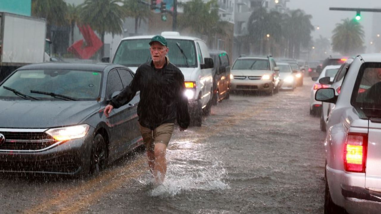
Miami, Florida — A slow-moving weather system developing near the Southwest Atlantic could bring several days of heavy rain, gusty winds and flash flooding to parts of the Bahamas and South Florida as October draws to a close.
The developing disturbance is expected to remain near the region for an extended period, potentially allowing repeated rounds of showers and thunderstorms to move across the same areas. Southeastern Florida, including Miami, could receive 3 to 5 inches of rain, raising concerns about localized flooding.
Although tropical or subtropical development remains possible, it is not guaranteed. For now, the primary concern is the potential for prolonged rainfall and hazardous weather across the region.
Why Could This Weather System Stall Near Florida?
The developing system is associated with an upper-level low that has become separated from the main jet stream. At the same time, a strong ridge of high pressure is building across eastern Canada and the North Atlantic.
This atmospheric pattern could prevent the disturbance from moving quickly, allowing a broad area of low pressure to develop over the warm waters near the Bahamas and the western Atlantic.
When weather systems move slowly, rain can repeatedly affect the same locations. Even if individual periods of rainfall are not unusually intense, the accumulation over several days can increase the risk of flooding.
The system’s eventual movement will depend on how the upper-level disturbance interacts with nearby fronts, high pressure and moisture flowing through the region.
Miami Could Receive 3 to 5 Inches of Rain
South Florida is among the areas being watched for potentially significant rainfall as the system develops offshore.
Forecast projections indicate that southeastern Florida, including Miami, could see 3 to 5 inches of rain. The exact totals will depend on where the heaviest showers and thunderstorms develop and how long they remain over the area.
The forecast also indicates a changing flash flood risk through the weekend. A Level 1 out of 4 flash flood risk is indicated for Friday, followed by a Level 2 out of 4 risk on Saturday.
These risk levels indicate the potential for localized flooding, but they do not mean flooding will occur everywhere within the forecast area.
Heavy rain can overwhelm drainage systems, flood low-lying streets and create hazardous driving conditions. Areas that experience repeated thunderstorms could face a greater risk if rainfall accumulates faster than water can drain away.
Residents should monitor updated local forecasts and official alerts, particularly if they live in flood-prone neighborhoods or areas with poor drainage.
Bahamas and Nearby Islands Could Face Days of Rain
The Bahamas and nearby islands could also experience an extended period of unsettled weather as the disturbance remains near the Southwest Atlantic.
Repeated rounds of showers, heavy rain and gusty winds are possible across the Bahamas and surrounding areas, including Hispaniola and Puerto Rico.
The duration of the system is an important factor. Rather than producing one brief period of rain, a slow-moving disturbance could bring multiple rounds of precipitation over several days.
Localized flooding may become a concern wherever persistent rainfall combines with saturated ground, limited drainage or stronger thunderstorms.
People planning travel between islands should watch for changing weather conditions, as heavy showers and gusty winds can affect road travel, marine activities and outdoor plans.
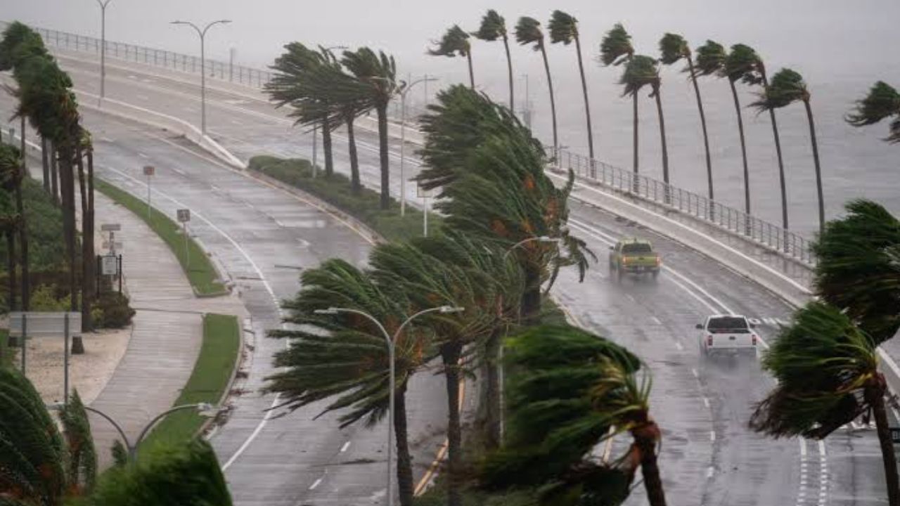
60 MPH Wind Gusts and 6-Foot Coastal Tides Possible as Nor’easter Strengthens Near the East Coast
Could the System Become a Tropical Storm?
Tropical development remains possible across parts of the western Caribbean, the Gulf of America and the Southwest Atlantic, but forecasters cannot assume the disturbance will become a named storm.
The system is initially expected to have a cold-core structure, which differs from the warm-core structure associated with mature tropical cyclones.
Strong wind shear and intrusions of dry air could interfere with the organization of thunderstorms and prevent the disturbance from developing into a well-organized tropical system.
However, if thunderstorms become more concentrated near the center and the system remains over warm ocean water, subtropical or tropical development could become possible.
Such a change would depend on how the disturbance evolves over time. Until clearer signs of organization emerge, the potential for tropical development should be treated as uncertain rather than inevitable.
What Should Florida Residents Watch Next?
The most important factors to monitor are the system’s movement, rainfall forecasts and the development of any persistent thunderstorms near South Florida and the Bahamas.
Residents should pay attention to local weather alerts, avoid driving through flooded roads and reconsider outdoor activities if heavy rain or strong wind gusts are expected.
People in flood-prone areas may also want to review local emergency plans and make sure they can receive weather warnings if conditions deteriorate.
Even without tropical development, a slow-moving weather system can produce significant impacts when heavy rain persists over the same region.
Do you live in South Florida or the Bahamas? Are you preparing for the possibility of several days of heavy rain and flooding? Share your local forecast and thoughts in the comments below.

2 thoughts on “Florida Weather Alert: Slow-Moving System Could Bring Days of Rain and Flash Flooding”