Sea Bright, New Jersey — Flooded neighborhoods, damaged roads, power outages and dangerous coastal conditions stretched across the United States over the weekend, as a powerful nor’easter battered the East Coast while hurricanes brought additional threats to Hawaii and Mexico.
The chaotic stretch of weather included a deadly nor’easter, Hurricane Nolo near Hawaii, Hurricane Polo near Mexico, a wildfire, possible volcanic activity and the unusual return of a so-called “zombie storm.” By Monday, another tropical storm had formed in the Atlantic.
Here is a look at the biggest weather events from the weekend and what could come next.
Nor’easter Leaves More Than 200,000 Without Power
The season’s first nor’easter brought damaging winds, coastal flooding and powerful waves to communities along the Northeast.
More than 200,000 customers lost power at various points during the storm, while flooding disrupted roads and travel across several states.
In New York City, a New York City Housing Authority employee was killed Saturday after being struck by a falling tree.
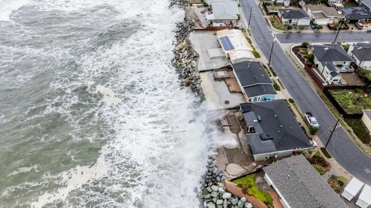
Along the Massachusetts coast, powerful waves repeatedly crashed over seawalls and reached homes in Scituate as multiple high tides prolonged the coastal flooding.
The combination of strong winds, high surf and repeated tidal cycles made it difficult for some communities to recover before the next round of water arrived.
New Jersey Flooding Forces Dozens of Rescues
The Jersey Shore experienced some of the most serious coastal flooding.
In Sea Bright, New Jersey, first responders reported about 90 water rescues Saturday as seawater surrounded homes and flooded streets.
Flooding also forced the closure of the Route 72 bridge leading to Long Beach Island, cutting off an important connection to the barrier island.
Wind gusts reached 74 mph on Long Beach Island, while more than 69,000 New Jersey customers lost power. The combination of strong onshore winds and high water pushed seawater farther inland, leaving some neighborhoods surrounded by floodwater.
Outer Banks Highway Damaged by Ocean Overwash
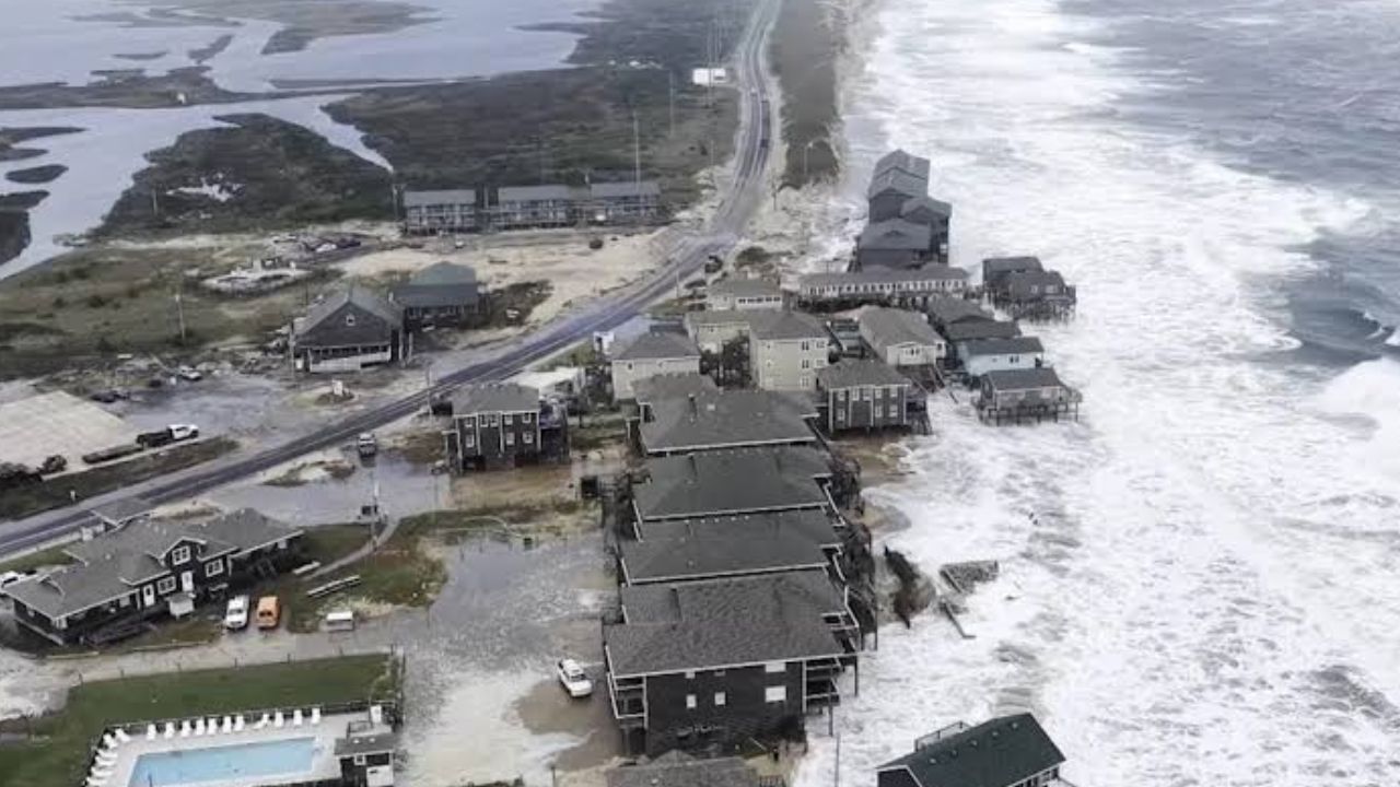
North Carolina’s Outer Banks also suffered significant damage. Several days of persistent onshore winds pushed ocean water across portions of the barrier islands, forcing closures along N.C. Highway 12.
An initial assessment found roughly 1,000 feet of roadway near the Pea Island Visitor Center had been undermined or damaged.
An emergency ferry route that had not been used for nearly 13 years was brought back into service to transport people and supplies between Hatteras Island and the North Carolina mainland.
North Carolina Department of Transportation Communications Officer Tim Hass told:
“It is not common, but the road has been damaged before, notably by Hurricanes Irene and Sandy in 2011 and 2012. Those were also times that the emergency ferry route has been placed in operation,” Hass said.
Meanwhile, communities around Virginia’s Hampton Roads continued dealing with standing water, with some neighborhoods unable to drain before another high tide arrived.
Storm Reveals Possible 142-Year-Old Shipwreck
The powerful coastal storm also uncovered a piece of history on Nantucket.
Along the island’s south shore, residents discovered wooden wreckage exposed by the storm’s waves and shifting sand. The remains are believed to be connected to the Warren Sawyer, a schooner that ran aground in December 1884.
A resident spotted the exposed timbers Saturday after the nor’easter removed enough sand to reveal the potentially historic wreckage.
Hurricane Nolo Brings Heavy Rain to Hawaii
While the East Coast battled the nor’easter, Hawaii was dealing with Hurricane Nolo.
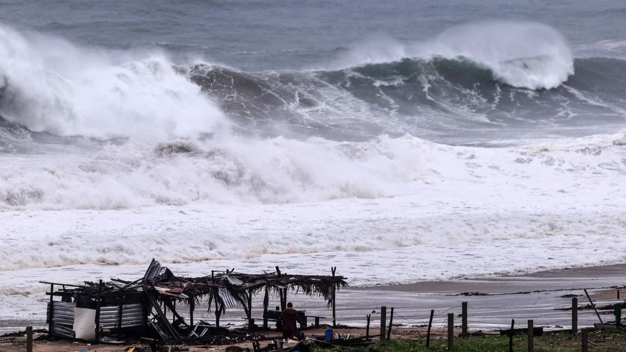
Nolo strengthened into a Category 4 hurricane Sunday while remaining south of Hawaii, but the storm still brought significant effects to the islands.
High winds forced the closure of Kohala Mountain Road, while some locations on the Big Island recorded more than 17 inches of rain over three days.
Statewide power outages topped 16,000 early Sunday.
On Maui, another emergency unfolded when a brush fire erupted near Olowalu Village. Evacuations were ordered and Honoapiʻilani Highway was temporarily closed.
At the same time, Hawaiian Volcano Observatory scientists continued monitoring Kīlauea for signs of another eruptive episode after venting activity was observed ahead of Nolo’s close approach.
Hurricane Polo Hits Mexico After Reaching Category 5 Strength
Hurricane Polo added another major threat to the Pacific.
The hurricane entered the weekend after reaching Category 5 strength with winds of 180 mph Friday. Although it weakened afterward, Polo remained dangerous as it approached northwestern Mexico.
The storm made its first landfall in Baja California Sur, with another landfall on mainland Mexico expected early Tuesday. Forecasters warned of damaging winds, life-threatening storm surge and flash flooding.
The storm’s effects also reached California, where teams worked to protect approximately 200 sea turtle eggs from coastal impacts. Two olive ridley sea turtles had recently laid nests that were reportedly the first of their kind recorded in California.
Hurricane Polo’s Moisture Could Trigger Major Flooding Across Texas and the Southwest This Week
‘Zombie Storm’ Fay Makes an Unusual Comeback
The Atlantic produced its own unusual weather story.
Fay lost its tropical characteristics Tuesday before reorganizing and regaining tropical storm status late Wednesday. That unusual revival earned the system the unofficial nickname “zombie storm.”
By Monday, Fay had weakened into a tropical depression, marking another unusual chapter in an already active stretch of weather.
The broader Pacific activity also fits a pattern often associated with El Niño, when warmer waters and reduced wind shear can support tropical development in the eastern and central Pacific.
Tropical Storm Hanna Forms as Northeast Finally Improves
The weather pattern remained active Monday when Tropical Storm Hanna formed about 850 miles northeast of Bermuda, becoming the Atlantic season’s eighth named storm.
Hanna had sustained winds of 45 mph and was moving east. Forecast guidance did not indicate direct impacts on the United States.
Meanwhile, the nor’easter was finally beginning to pull away from the Northeast. Conditions were expected to improve significantly by late Monday, although lingering coastal flooding could continue in areas where water remained slow to drain.
After three days of hurricanes, flooding, coastal damage and an unusual tropical storm comeback, communities across the country were finally beginning to shift from emergency response toward cleanup and recovery.
Did your area experience any of the extreme weather this weekend? Share what conditions were like where you live and tell us which part of this unusual weather stretch caught your attention most.