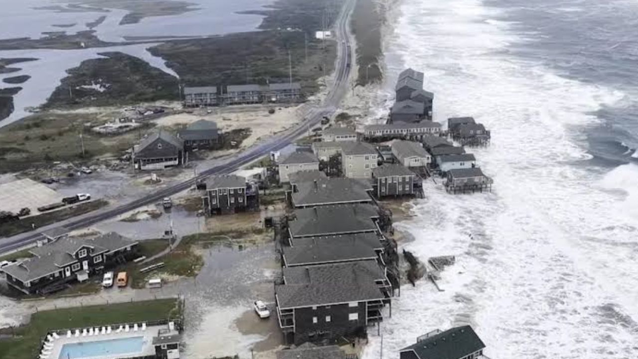
Boston, Massachusetts — A strengthening nor’easter is charging north along the East Coast, threatening millions with coastal flooding, dangerous surf, powerful winds and severe beach erosion from the Outer Banks to New England. The storm is expected to intensify through the weekend, with the most significant impacts arriving from Friday night through Sunday.
The storm is already producing coastal flooding from New Jersey to North Carolina, while conditions are expected to deteriorate as the system strengthens. Areas from North Carolina to Maine could experience prolonged rain, strong winds and additional coastal flooding, with power outages also possible.
The most serious conditions are expected across Boston, coastal Massachusetts, Rhode Island and Connecticut, where wind gusts could reach 50 to 65 mph and rainfall could exceed 5 inches.
Nor’easter Intensifies Along the East Coast
The storm is expected to consolidate and strengthen Friday as it tracks northward along the coastline.
From the Outer Banks to New York City and southern New England, residents can expect increasing winds, pounding surf and periods of heavy rain.
Along the Outer Banks and Mid-Atlantic, wind gusts could reach 40 to 50 mph, while winds just offshore may approach 60 mph. Offshore waves could climb to 15 to 18 feet, creating dangerous conditions along exposed beaches.
Trapped water along the coast could also prevent normal drainage, worsening flooding during high-tide cycles.
New Jersey and New York Prepare for Flooding
Along the Jersey Shore, onshore wind gusts could reach 35 to 45 mph, with widespread moderate high-tide flooding expected.
New York City will see rain develop by the middle of Friday afternoon as winds strengthen. Gusts of up to 40 mph will be possible, while coastal flooding could develop later in the day across vulnerable sections of eastern and northern Queens, southern Brooklyn and Staten Island.
The combination of strong onshore winds, rising water levels and high tides could create difficult conditions near coastal roads and waterfront areas.
Travel could also become increasingly challenging along the Northeast corridor as rain and strong winds spread northward.
Boston and Coastal New England Face the Worst
The nor’easter is expected to reach peak intensity Saturday, when the storm could deliver its most significant impacts across New England.
Boston and coastal Massachusetts are expected to experience heavy rain, street flooding and powerful winds, with gusts potentially reaching 50 to 60 mph late Saturday.
Southern New England will also see worsening conditions as rain bands become heavier and coastal water levels rise.
From Long Island through Boston, strong northeast winds will generate substantial wave action along south-facing beaches. Beach erosion and tidal flooding could begin during the morning and become more significant as additional high-tide cycles arrive.
Long Island Sound and surrounding bays will also be monitored for coastal flooding.
18-Foot Waves Threaten the Mid-Atlantic
The dangerous surf will extend far beyond Massachusetts.
From the Outer Banks to New Jersey, waves could remain as high as 15 to 18 feet, contributing to severe beach erosion and repeated coastal inundation.
The persistent northeast winds will push water toward the shoreline while high tides repeatedly raise water levels.
Nor’easter Takes Aim at the East Coast This Weekend With Heavy Rain, Flooding and 60-MPH Winds
That combination could make some coastal areas especially vulnerable to flooding and significant beach loss.
Sunday Could Bring Prolonged Impacts
The storm is expected to remain near peak intensity Sunday as it meanders close to the coastline.
That means the threat may not end once the heaviest rain arrives Saturday. Coastal flooding, heavy rain bands and strong winds could continue into Sunday, particularly across New England.
Boston and coastal communities could experience additional rain and wind gusts approaching 60 mph.
High tides combined with trapped coastal water could keep flooding and beach erosion elevated through both morning and evening tide cycles.
Meanwhile, continued rainfall could increase the risk of inland flooding in areas that receive repeated heavy rain.
Conditions Gradually Improve After the Storm
Across New Jersey and the Mid-Atlantic, rain should gradually begin clearing Sunday, but elevated water levels could keep moderate coastal flooding in place through at least the morning high tide.
Farther north, seas from Cape Cod to the Outer Banks should slowly subside after the storm begins moving away. However, dangerous surf, beach erosion and residual high-tide flooding could take several days to fully diminish.
Persistent light rain may continue rotating around the departing nor’easter, keeping some areas unsettled even after the storm’s strongest winds begin to weaken.
Is your area in the path of this nor’easter? Share your city and what conditions you’re experiencing in the comments below.