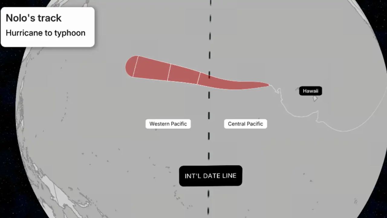
Honolulu, Hawaii — Hurricane Nolo could soon become Typhoon Nolo, but the storm itself will not be renamed. After weakening to a tropical storm earlier in the week, Nolo remains active and is forecast to cross the International Date Line this weekend, triggering a change in its official classification.
The change can sound confusing, but it is based entirely on where the storm is located, rather than a sudden transformation in its physical structure.
When Nolo crosses from the Central Pacific into the Western Pacific, it will move from one tropical cyclone basin into another. That means the storm’s classification will change from hurricane to typhoon while its assigned name remains exactly the same.
Crossing the Date Line Changes the Classification
The International Date Line runs roughly along 180 degrees longitude and serves as the geographic boundary between the Central Pacific and Western Pacific basins.
When a tropical cyclone crosses that boundary, its terminology can change.
A storm moving westward from the Central Pacific into the Western Pacific that meets the required wind threshold is referred to as a typhoon rather than a hurricane.
There is no new storm forming and no separate weather system taking over. It remains the same circulation, with the same name and the same history.
For Nolo, crossing the International Date Line would therefore mean that the storm officially becomes Typhoon Nolo.
Nolo Would Keep Its Name
One of the biggest misconceptions surrounding the transition is that Nolo would receive a completely new name. That is not what happens.
Under international tropical cyclone naming practices, Nolo keeps its assigned name as it moves between basins. The geographical terminology changes, but the storm’s identity does not.
In other words, Hurricane Nolo and Typhoon Nolo would refer to the same tropical cyclone, simply described according to the basin in which it is located.
The change is similar to switching between regional terms for the same type of weather system.
Wind Speed Still Matters
Crossing the International Date Line alone does not guarantee that Nolo will immediately be called a typhoon. The storm’s sustained wind speed will still determine its classification.
A tropical cyclone generally needs sustained winds of at least 74 mph to be classified as a typhoon. If Nolo remains below that threshold when it crosses the date line, it would continue to be classified as Tropical Storm Nolo.
If the storm strengthens and reaches the required threshold after entering the Western Pacific, its classification would change accordingly.
Students Forced Out of Fort Worth Middle School After Storm Damage Makes Building Unsafe
There is also another possibility if Nolo becomes exceptionally strong.
A storm with sustained winds of at least 150 mph would qualify as a Super Typhoon under the commonly used Western Pacific classification.
Forecasting Responsibility Will Shift
Nolo’s movement across the basin boundary also affects which agencies are responsible for officially monitoring and forecasting the storm.
While the storm is in the Central Pacific, tracking responsibilities involve the Central Pacific Hurricane Center.
Once it moves into the Western Pacific, forecasting duties shift to agencies responsible for that region, including the Japan Meteorological Agency and Joint Typhoon Warning Center.
That change does not mean the storm itself has changed dramatically. Instead, it reflects the way international forecasting responsibilities are divided geographically.
Nolo Would Not Be the First Storm to Make the Transition
A hurricane becoming a typhoon after crossing the International Date Line is unusual, but it is not unprecedented.
Several notable storms have made the same transition in previous years. Hurricane Ioke became Typhoon Ioke in 2006, while Hurricane Genevieve made the transition in 2014.
More recently, Hurricane Dora crossed the International Date Line in August 2023 and became Typhoon Dora. Those storms demonstrate why Nolo can keep its name even though the word used to describe it changes.
The Storm’s Location Will Tell the Story
For now, Nolo remains a tropical cyclone moving toward a geographic boundary that can change its official designation.
If it crosses the International Date Line while maintaining winds strong enough for typhoon classification, Hurricane Nolo will become Typhoon Nolo without being renamed.
The key distinction is simple: hurricanes and typhoons are essentially the same type of tropical cyclone. The terminology depends primarily on which ocean basin the storm occupies.
So if Nolo crosses the date line this weekend, the storm will not be starting over. It will simply be entering a new basin—and receiving the regional title that comes with it.
Have you ever followed a storm that crossed from one tropical cyclone basin into another? Share your thoughts in the comments and let us know what you think about Nolo’s potential transition to a typhoon.