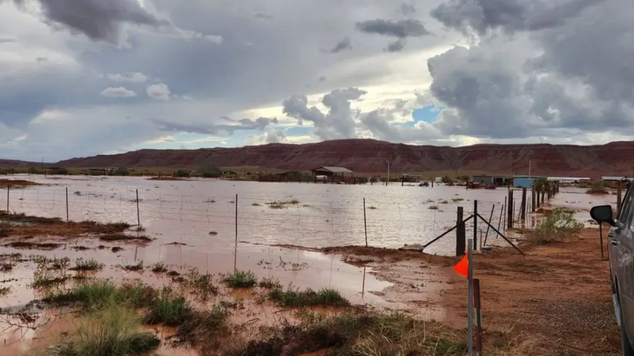
Phoenix, Arizona — A multiday storm system is raising concerns across the Southwest, with heavy rainfall, flash flooding and severe thunderstorms threatening communities from California to Colorado. Arizona faces particular concern as abundant tropical moisture could fuel intense downpours, damaging wind gusts, large hail and a few possible tornadoes.
Millions of people are under flood watches as repeated rounds of rain threaten to overwhelm already saturated ground. The risk is especially concerning near wildfire burn scars, where heavy rainfall can trigger debris flows, mudslides and dangerous runoff with little warning.
Forecasters are also watching the possibility of early-season mountain snow as colder air moves into higher elevations of the Sierra Nevada and Rocky Mountains.
Seven States Face a Growing Flood Threat
The developing weather pattern is expected to affect California, Arizona, Nevada, Utah, New Mexico, Colorado and parts of the surrounding Southwest region over several days.
Heavy rain and thunderstorms are already affecting parts of California and the Four Corners region. As tropical moisture continues moving into the area, additional storms could produce intense rainfall over locations that have already received significant precipitation.
One of the biggest concerns is a weather pattern known as training storms. This happens when thunderstorms repeatedly move over the same area, allowing rainfall to accumulate quickly.
The Weather Prediction Center is forecasting rainfall rates that could reach 2 inches per hour in some locations. At those rates, water can accumulate rapidly on roads, in washes and in low-lying areas.
Flash flooding can occur even when a storm lasts only a short time, particularly in narrow canyons and areas with poor drainage.
Wednesday Night: Arizona Faces Severe Storms and Flash Flooding
The overnight period into Thursday is expected to bring an elevated flood threat across much of Arizona and New Mexico, along with portions of Utah, Colorado and Southern California.
Arizona is among the areas of greatest concern because of the combination of abundant moisture, thunderstorms and conditions favorable for severe weather.
Storms could produce large hail, strong wind gusts and a few tornadoes, particularly along the Mogollon Rim and surrounding parts of Arizona.
Southern Utah and western New Mexico could also experience severe thunderstorms. Along the southern and central California coast, strong wind gusts and an isolated tornado threat are possible.
The combination of intense rainfall and severe thunderstorms means conditions could change quickly. Residents should watch for official warnings and avoid driving through flooded roads.
Thursday: Flood Risk Expands Across the Southwest
The flood threat is expected to continue Thursday as additional moisture moves into the region. Rain falling on already saturated soil could increase runoff and make flooding more likely.
Although the greatest flood concern is expected to shift away from California, substantial risks remain across Arizona, Nevada, New Mexico, Colorado and Utah.
Major population centers, including Phoenix, Tucson, Las Vegas and Albuquerque, are within the broader region being monitored for heavy rainfall and flooding.
Some forecast models suggest that atmospheric moisture levels could approach unusually high October values for the region. If the system delivers more moisture than currently anticipated, rainfall totals could exceed initial forecasts.
Severe thunderstorms could also develop again Thursday across parts of the Desert Southwest and Four Corners region. Arizona remains a particular concern for storms capable of producing damaging wind, hail and an isolated tornado.
Residents should not assume that a temporary break in rainfall means the threat has ended. Repeated storms can continue adding water to drainage systems, streams and low-lying areas.
Up to 5 Inches of Rain Possible in Isolated Areas
Forecast projections indicate that portions of the Desert Southwest could receive up to 3 inches of rain, while isolated locations could see totals approaching 5 inches.
Those amounts can create significant flash-flood concerns in areas where heavy rain is uncommon or where the ground cannot absorb water quickly enough.
Burn scars are particularly vulnerable because wildfire damage can leave slopes less able to absorb rainfall. Water can rush downhill carrying ash, rocks, branches and other debris.
Slot canyons and arroyos are also dangerous during heavy rain. Floodwater can move rapidly through these narrow channels, including when the rain falls some distance away.
People visiting national parks or planning outdoor activities across the Southwest should check local forecasts before departing and follow closures and evacuation instructions from authorities.
Never enter a flooded roadway or attempt to cross a flooded wash. Water depth and current strength can be difficult to judge, and conditions can become life-threatening quickly.
Florida Weather Alert: Slow-Moving System Could Bring Days of Rain and Flash Flooding
First Significant Mountain Snow Could Arrive
The storm system could also bring an early-season snowfall to higher elevations of the Sierra Nevada and Rocky Mountains. Widespread snowfall totals are forecast to remain below 6 inches, although isolated mountain peaks could receive up to a foot of snow.
The snowfall could provide an early base for ski areas preparing for the winter season. However, changing temperatures and precipitation types may create challenging travel conditions at higher elevations.
Drivers crossing mountain passes should be prepared for rain to change to snow as temperatures fall. Reduced visibility, slick roads and rapidly changing conditions may affect travel.
What Residents Should Watch Next
The storm’s track, the amount of tropical moisture entering the region and the repeated development of thunderstorms will determine how severe the impacts become.
Residents across the Southwest should monitor National Weather Service forecasts, flood watches, flash-flood warnings and severe thunderstorm alerts. Anyone near a burn scar, canyon or flood-prone area should take warnings seriously and be ready to move to safer ground if instructed.
Travelers should check conditions before heading into mountain areas or national parks, especially where heavy rain, debris flows or snow could affect roads.
The forecast may change as the system develops, and rainfall totals could increase if moisture levels prove higher than expected.
Are you experiencing heavy rain or severe weather in Arizona, California or another affected state? Share your local conditions in the comments and let others know what you’re seeing in your area.

One thought on “Flood Threat Spreads Across 7 States as Arizona Faces Severe Storms, Hail and Possible Tornadoes”