Boston, Massachusetts — Subtropical Storm Josephine formed over the Atlantic Ocean on Wednesday, October 21, as the system moved northward toward waters south of Cape Cod, bringing concerns about strong wind gusts, coastal flooding and dangerous surf along parts of the East Coast.
According to the National Hurricane Center (NHC), Josephine had maximum sustained winds of 65 mph when it formed and was located approximately 265 miles south of Nantucket, Massachusetts. The storm developed from a system previously monitored as Invest 93L after it acquired subtropical characteristics over the Atlantic.
Although Josephine is forecast to move away from the United States, its broad wind field and ocean swells could continue to affect coastal communities and marine conditions.
Subtropical Storm Josephine Forms Off the East Coast
Josephine developed as a low-pressure system moved over the warm waters of the Gulf Stream. Those warmer waters helped the system develop tropical characteristics as it gradually separated from a nearby frontal boundary.
The National Hurricane Center began issuing advisories after the system showed enough organized thunderstorm activity and other features associated with a subtropical storm.
Unlike a typical tropical cyclone, a subtropical storm has characteristics of both tropical and non-tropical weather systems. These storms can develop over the ocean and produce powerful winds, rough seas and hazardous coastal conditions.
At the time of its first advisory Wednesday evening, Josephine was moving north at approximately 6 mph. Forecasters expected the system to turn northeastward and accelerate as it moved farther into the Atlantic.
Where Could Strong Winds Hit?
Parts of the Northeast could experience gusty winds as Josephine moves offshore. The strongest impacts along the coast are expected to depend on the storm’s distance from land and the size of its wind field.
Forecast information provided for the system indicated that Long Island and eastern Massachusetts could see wind gusts of 30 to 40 mph. Nantucket and Martha’s Vineyard could experience stronger gusts exceeding 50 mph on Thursday.
These conditions could make travel more difficult in exposed areas and create hazards for boaters and people spending time along the coast.
The National Hurricane Center also reported that winds of at least 40 mph extended outward as far as 415 miles from the storm’s center. That broad wind field means hazardous marine conditions can extend well beyond the area immediately surrounding the low-pressure center.
Residents should follow updates from local National Weather Service offices for the latest information about wind conditions and any advisories affecting their communities.
Flood Threat Spreads Across 7 States as Arizona Faces Severe Storms, Hail and Possible Tornadoes
Will Josephine Make Landfall in New England?
Josephine is forecast to move northeastward and then eastward, taking the system away from the U.S. coastline.
The National Hurricane Center’s forecast indicated that the storm would remain south of Nova Scotia and Newfoundland as it moved across the Atlantic. The system could strengthen further before transitioning into a post-tropical or extratropical cyclone.
The forecast does not call for Josephine to make landfall along the Northeast coast. However, the storm can still generate strong winds, large ocean swells and dangerous surf without moving directly over land.
As the system accelerates away from the United States, its effects on coastal areas are expected to gradually diminish, although conditions will vary by location.
Coastal Flooding Remains a Concern in Parts of the East Coast
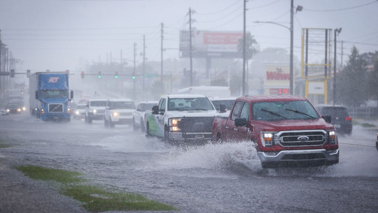
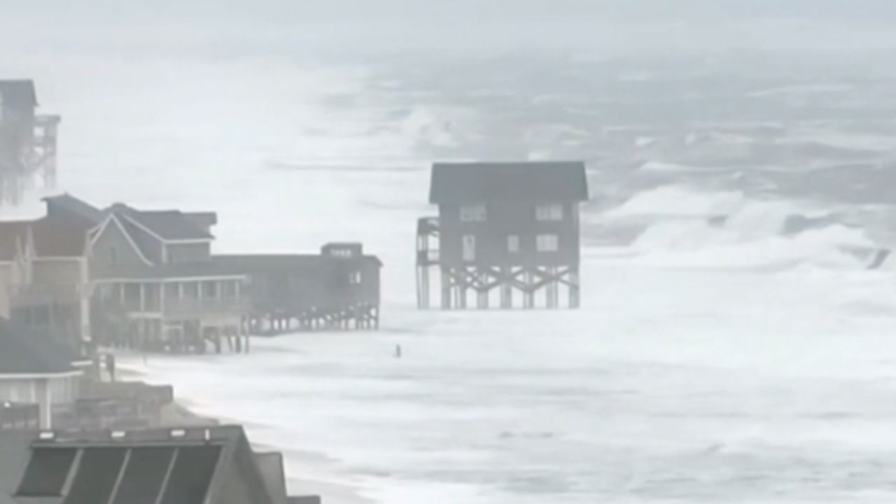
Josephine’s impacts extend beyond wind gusts. Coastal flooding has also been a concern along portions of the Mid-Atlantic and East Coast, particularly around high tide.
The forecast information provided with the storm report indicated that Wednesday afternoon’s high tide was expected to be the last period with coastal flooding for many areas outside the Chesapeake Bay.
However, minor to moderate coastal flooding could persist in parts of the Chesapeake Bay into Thursday or early Friday, depending on local conditions and the timing of high tides.
Residents in vulnerable coastal locations should pay attention to local flood advisories and avoid driving through flooded roads. Even relatively shallow coastal flooding can create dangerous conditions for motorists and pedestrians.
Dangerous Surf and Rip Currents Could Continue
Large swells generated by Josephine are expected to affect portions of the East Coast and Atlantic Canada. These swells can create dangerous surf and increase the risk of rip currents, even at beaches far from the storm’s center.
Rip currents can pull swimmers away from shore and become hazardous when waves are strong or conditions change quickly.
Beachgoers should check local beach forecasts, follow lifeguard instructions and stay out of the water when warnings or closures are in effect. Boaters should also monitor marine forecasts because rough seas and strong winds can make offshore travel dangerous.
What Happens Next With Storm Josephine?
Forecasters expect Josephine to accelerate northeastward before moving east across the Atlantic. The system could briefly affect marine conditions near Atlantic Canada before gradually weakening and becoming absorbed into a larger low-pressure system.
For residents along the Northeast coast, the main concerns are gusty winds, coastal flooding in vulnerable areas, large swells and dangerous rip currents.
The storm’s track away from the United States reduces the likelihood of direct land impacts, but coastal hazards can remain significant while the system is nearby.
Residents should continue checking official forecasts for changes in wind projections, coastal conditions and local advisories as Josephine moves farther offshore.
Are you noticing stronger winds, rough surf or coastal flooding in your area? Share your local weather conditions in the comments below, and let others know what you’re seeing along the East Coast.