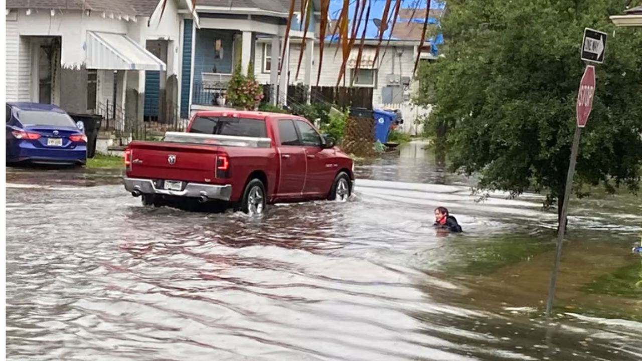
New Orleans, Louisiana — Millions of Americans across the East are facing a potentially dangerous stretch of heavy rain, with repeated rounds of tropical moisture expected to bring downpours, thunderstorms and an increasing risk of flooding beginning Friday.
Moisture streaming in from the Pacific, Caribbean and Gulf of America will combine across the region as an upper-level trough pulls the moisture farther inland. The setup could keep showers and thunderstorms active for several days, creating the potential for a prolonged flood threat.
Instead of one quick round of rain, forecasters are watching for multiple waves of heavy precipitation that could leave some areas increasingly vulnerable to flash flooding.
Southern States Could See the Heaviest Rain
The highest rainfall totals through Monday are expected across Louisiana, Mississippi, Alabama and Georgia, where widespread rainfall of 2 to 3 inches is possible.
Forecasters said:
“The highest rain totals through Monday will be across Louisiana, Mississippi, Alabama and Georgia, where a widespread 2-3 inches is likely,” forecasters said. “Totals of 3-5 inches or more are most likely across southern Louisiana and Mississippi.”
The heaviest rainfall could become particularly concerning in southern Louisiana and Mississippi, where 3 to 5 inches or more could fall during the event.
As tropical moisture continues moving northward, it will encounter an area of high pressure. That interaction could help create another period of enhanced rainfall across the region.
Flood Risk Extends Toward the Ohio Valley
The potential impacts will not be limited to the Gulf Coast.
The developing weather pattern could stretch from the Gulf Coast into the Ohio Valley and potentially toward the Northeast, bringing repeated showers and thunderstorms along the way.
A Level 2 out of 4 flash flood risk is in place for Saturday and Sunday across Louisiana, Mississippi and Alabama.
The concern is that repeated storms could drop substantial amounts of rain over the same locations. When that happens, soils can become saturated quickly, allowing additional rainfall to run off into streets, streams and low-lying areas.
Popular cities including New Orleans and Atlanta could receive around 3 to 5 inches of rain, although exact totals will depend on where the heaviest storms develop.
Northeast Could Avoid the Worst of the Rain
The weather picture is somewhat different farther north.
Much of the Northeast is expected to remain relatively dry following the nasty nor’easter conditions that affected the region last week. A strong area of high pressure should help keep much of the heaviest rainfall concentrated across the southern United States.
However, that does not mean the Northeast will remain completely dry.
The best chances for showers in areas recently affected by the nor’easter could arrive Sunday, as moisture begins pushing farther north.
Coastal Flooding Remains a Concern
Some locations could face additional water-related problems even if they do not receive the heaviest rainfall. Annapolis, Maryland, is under a Coastal Flood Advisory as storms begin developing across the broader region.
Coastal communities will need to watch both rainfall and water levels as the unsettled weather pattern develops. Heavy rain falling at the same time as elevated coastal water could create additional problems in vulnerable areas.
The combination of tropical moisture, thunderstorms and lingering coastal concerns makes the weekend forecast one that residents across several states will need to monitor closely.
Moisture Could Remain Into Early Next Week
The wet pattern is not expected to disappear quickly.
A large plume of moisture from the Gulf is likely to remain across the East into early next week, keeping the possibility of additional showers and thunderstorms alive even after the initial weekend rainfall.
That means some communities could experience several rounds of rain rather than a single storm system.
For residents in Louisiana, Mississippi, Alabama and Georgia, the greatest concern remains the potential for flash flooding from repeated heavy downpours. Farther north, rainfall chances may increase as the moisture plume expands.
With millions of people potentially affected, weather conditions could change quickly as individual thunderstorms develop and rainfall totals increase.
Is heavy rain expected in your area this weekend? Share your city and state in the comments and let us know whether you’re preparing for the potential flooding and storms.
One thought on “Heavy Rain Is Set to Drench Millions Across the East as Tropical Moisture Fuels a Dangerous Week-Long Flood Threat”