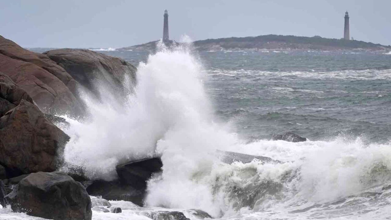
Nags Head, North Carolina — Another powerful nor’easter could bring days of strong winds, coastal flooding, dangerous surf and renewed beach erosion to the Mid-Atlantic coast next week, raising concerns for communities still recovering from a major coastal storm that struck the region three weeks ago.
The developing storm is expected to strengthen near the coast and move westward, potentially bringing prolonged periods of gusty winds and elevated tides from the Delmarva Peninsula to North Carolina’s Outer Banks. The effects could extend beyond the immediate coastline, with heavy rain possible in parts of New Jersey and the eastern Carolinas.
The approaching system will also follow a sharp change in Northeast weather, with severe thunderstorms giving way to colder winds and even snow showers in some areas this weekend.
Which Coastal Areas Face the Greatest Risk?
The most significant impacts are expected near the storm’s center, particularly along North Carolina’s Outer Banks, southeastern Virginia, and the beach communities of Maryland and Delaware.
Meteorologists say wind gusts of 40 to 60 mph could stretch from far southern New Jersey to the area near Cape Lookout, North Carolina. The strongest gusts are expected closest to the storm, from southeastern Virginia to the Outer Banks.
Such prolonged winds could worsen existing beach erosion, make travel difficult and push seawater into vulnerable coastal neighborhoods.
The storm’s exact track will play an important role in determining which communities experience the most severe conditions. A shift closer to the shoreline could also increase the potential for heavy rain and localized flooding.
Outer Banks Highway 12 Could Face Another Closure
One of the biggest concerns involves North Carolina’s Outer Banks, where storm-driven water can wash across exposed roads and disrupt transportation.
North Carolina Highway 12 could become impassable again because of ocean overwash, potentially leaving some sections difficult or impossible to travel for a period of time. Significant damage is also possible if waves and elevated water levels persist.
Other coastal roads and low-lying streets in beach communities could become inundated, particularly around high tide.
Residents and visitors should pay attention to local road conditions and any travel advisories issued as the storm approaches. Even when a road is not completely submerged, standing water, sand and debris can make driving dangerous.
Coastal Flooding Could Push Tides Above Normal
The combination of strong northeast winds and the storm’s prolonged presence near the coast could cause water levels to rise substantially.
Forecast projections indicate tides could reach 2 to 3 feet above normal, with localized levels potentially reaching 4 to 6 feet above normal from southeastern Virginia to northeastern North Carolina.
Water could accumulate in back bays and other vulnerable coastal areas, increasing the risk of flooding in neighborhoods that are particularly exposed to changing tides.
There is one potentially moderating factor. The Moon is expected to remain in its first-quarter phase during much of the storm, meaning astronomical tides are not expected to be as extreme as they were during the September nor’easter, which coincided with the approach of a full moon.
However, that does not eliminate the threat. Wind direction, storm intensity and local geography can still produce significant coastal flooding.
Dangerous Seas and Rip Currents Could Disrupt Marine Activity
The storm could create an extended period of hazardous marine conditions from Delaware Bay to the lower Chesapeake Bay and along the Carolina coast.
Offshore seas averaging 15 to 25 feet could develop by early next week, according to the forecast information provided. Conditions near coastal inlets could be particularly rough, creating additional risks for small boats and other marine traffic.
Fishing operations, recreational boating and commercial vessels may experience disruptions throughout the storm’s passage.
The effects could also extend farther south along Florida’s Atlantic coast, where heavy surf could increase the risk of strong rip currents.
Swimmers should avoid entering rough water and follow beach warnings. Rip currents can pull people away from shore even when waves near the beach appear manageable.
Could the Storm Become a Named Tropical System?
Another question is whether the developing low-pressure system could acquire tropical or subtropical characteristics.
If it becomes a named tropical or subtropical storm, Josephine would be the next name on the 2026 Atlantic hurricane season list, according to the information provided.
However, the possibility of a name does not mean the system is certain to become tropical. Nor’easters are generally cold-season or transitional coastal cyclones, and their development differs from that of tropical storms.
Forecasters will need to monitor the system’s structure and evolution before determining whether it meets the criteria for tropical or subtropical classification.
Drier Weather Expected Inland
While coastal communities prepare for potentially disruptive conditions, much of the Midwest and the interior Northeast and Southeast could experience dry, sunny weather as the storm strengthens offshore.
The contrast could be substantial, with coastal areas dealing with persistent winds, rough seas and flooding concerns while locations farther inland experience calmer conditions.
The storm’s timing and track remain important factors to watch as the weekend approaches and the system develops next week.
Residents along vulnerable stretches of the Mid-Atlantic coast should monitor updated forecasts, prepare for possible travel disruptions and stay alert for coastal flood and marine advisories.
Do you live along the Mid-Atlantic coast? Are you concerned about renewed beach erosion, flooding or another possible Highway 12 closure? Share your local conditions and thoughts in the comments below.