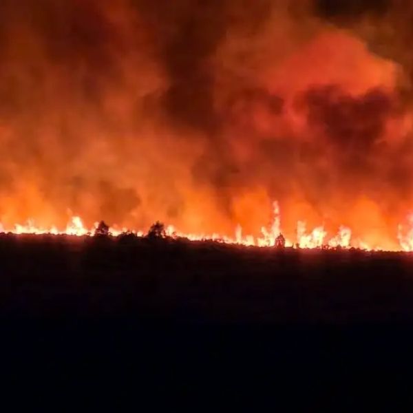
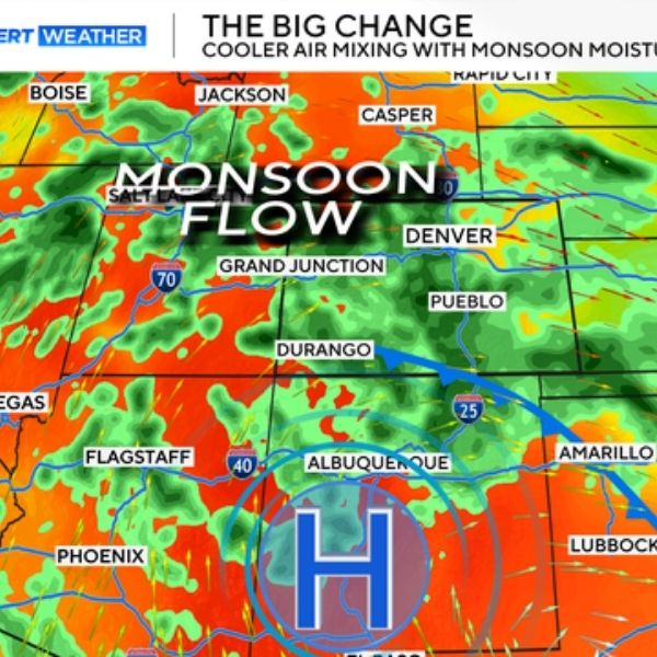
Multiple wildfires continue to burn across western Colorado, scorching nearly 170,000 acres as hot, dry, and windy conditions fuel rapid growth. According to the National Weather Service, rain showers are expected to begin Sunday and continue through midweek, bringing both relief and new challenges.
While the incoming storms could help dampen flames, officials warn of gusty winds, frequent lightning, and flash flooding on burn scars, which could spark new fires and worsen conditions.
Major Fires Burning Across Colorado
Lee & Elk Fires — Near Meeker
-
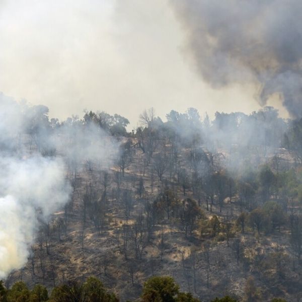
The Lee Fire has burned 137,758 acres, making it Colorado’s fifth-largest wildfire on record.
-
As of Sunday morning, it is 86% contained.
-
The nearby Elk Fire, which consumed over 14,500 acres, reached full containment last week.
-
Together, the fires destroyed at least five homes and 14 outbuildings.
-
Both were sparked by lightning on Aug. 2.
-
Rain showers and cooler temperatures helped slow the flames last week, but thunderstorms bring new risks of lightning and flooding.
-
All mandatory evacuations have been lifted, though some areas remain under pre-evacuation status in Rio Blanco and Garfield counties.
Derby Fire — Eagle & Garfield Counties
-
The Derby Fire has grown rapidly, now burning 5,248 acres with 0% containment.
-
Discovered on Aug. 17 in remote, rugged terrain of the White River National Forest, about 15 miles from Dotsero.
-
Mandatory evacuations remain in place for parts of northwest Eagle County and sections of Garfield County, including areas near Gypsum.
-
Fire officials warn that overnight winds continue to fuel its spread despite cooler conditions.
-
At least one structure has been destroyed, though details remain unclear.
-
The U.S. Forest Service expanded closures in affected regions, including sections of the White River National Forest and surrounding BLM lands.
Stoner Mesa Fire — Near Dolores
-
Burning 10,233 acres in a remote section of the San Juan National Forest.
-
Sparked by lightning, the fire is 41% contained as of Sunday morning.
-
Pre-evacuation warnings were lifted Saturday, but several nearby areas remain under monitor status, including Mavreeso, Dunton, Lizard Head, Fish Creek, Gobble Creek, and Rico.
-
Officials expect thunderstorms with gusty winds on Sunday, which could cause flare-ups despite overall slowing fire activity.
-
Portions of the San Juan National Forest remain closed.
Air Quality Impacts
The Colorado Department of Public Health and Environment (CDPHE) issued air quality alerts Sunday morning for wildfire smoke near the Derby and Stoner Mesa fires.
Affected regions include:
-
Southeastern Dolores County
-
Northeastern Montezuma County
-
Western Eagle County
-
Eastern Garfield County
Health officials advise:
-
Limiting outdoor activities when heavy smoke is present.
-
Staying indoors if visibility drops below 5 miles — a sign air quality has reached unhealthy levels.
-
High-risk groups, including children, older adults, and people with respiratory or heart conditions, should take extra precautions.
Looking Ahead
-
Rain is expected to help suppress fire activity, but excessive precipitation may lead to flooding, mudslides, and flare-ups.
-
Fire crews continue working to strengthen containment lines and protect nearby communities.
-
Evacuation maps for Eagle, Garfield, Rio Blanco, and Dolores counties remain updated online as conditions evolve.
This article has been carefully fact-checked by our editorial team to ensure accuracy and eliminate any misleading information. We are committed to maintaining the highest standards of integrity in our content.

Katie is a senior who has been on staff for three years. Her favorite type of stories to write is reviews and features. Katie’s favorite ice cream flavor is strawberry.


Leave a Reply