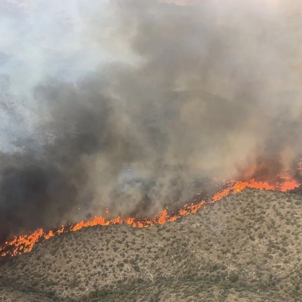
Wildfires in central and eastern Arizona continued to burn with little containment this week, while blazes in the northern part of the state appeared more under control.
The Billy Fire, south of Young in Gila County, had burned over 12,000 acres and was 16% contained as of Aug. 11, according to InciWeb. Nearby communities were evacuated.
The Bronco Fire, on the eastern side of the San Carlos Apache Indian Reservation, was 0% contained at just over 18,000 acres as of Aug. 10. About eight miles east, the Indian Creek Fire on the Fort Apache Indian Reservation had burned slightly more than 2,500 acres and was also at 0% containment as of Aug. 11.
On the Grand Canyon’s North Rim, the Dragon Bravo Fire, burning since July 4, became Arizona’s seventh-largest wildfire since 1990, reaching over 143,000 acres on Aug. 11 with 44% containment. The White Sage Fire on the Kaibab Plateau remained at nearly 59,000 acres and 95% containment since Aug. 1.
In central Arizona, the Kirkland Fire near Prescott was fully contained at 913 acres as of Aug. 11.
Billy Fire
Evacuations were ordered for Ellison Ranch and Murphy Ranch on Aug. 10. Circle Ranch, Cook Ranch, Elk’s Camp, Johnson Ranch, and Trachta Ranch remained on “set” status, meaning residents needed to be ready to leave if ordered.
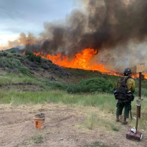
The lightning-caused fire began July 9 and had significant growth on Aug. 10 due to strong morning winds near Globe and aerial ignitions to the west. More than 460 personnel were assigned to the fire, supported by helicopters, engines, water tenders, and medical crews.
Forecasts called for a 20% chance of rain with erratic winds from afternoon thunderstorms. The rugged terrain and leftover hazardous materials from old mining sites posed safety risks for crews. Some roads, trails, and areas of the Tonto National Forest were closed through Sept. 30. A pilot car was guiding vehicles along SR 288 through the fire zone.
Bronco Fire
This lightning-caused blaze started Aug. 3 and remained uncontained at 18,109 acres as of Aug. 11. About 300 firefighters were on scene, building and reinforcing fire lines with bulldozers.
Winds up to 25 mph were expected, with rain possible Aug. 13–15. Stage 3 fire restrictions on San Carlos Apache tribal lands prohibited campfires. Several areas, including Hilltop, Point of Pines, Route 8, and Seneca, were closed to the public.
Indian Creek Fire
At 2,513 acres and 0% containment, the Indian Creek Fire continued to produce strong, erratic winds from developing thunderstorms. Firefighters were working on securing lines along Y2 Road and exploring opportunities to attack the fire from the northeast. Contingency lines were being built along Y4 Road.
Closures on Fort Apache tribal lands included areas from Amos Wash to the Black River, north to the Y40 bridge, northwest to the Y70/40 junction, and up to the community of Seven Mile, before looping back to Highway 73 and Amos Wash.
This article has been carefully fact-checked by our editorial team to ensure accuracy and eliminate any misleading information. We are committed to maintaining the highest standards of integrity in our content.

Katie is a senior who has been on staff for three years. Her favorite type of stories to write is reviews and features. Katie’s favorite ice cream flavor is strawberry.


Leave a Reply