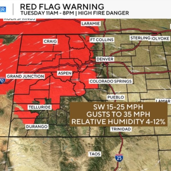
Colorado is in for a week of intense heat and elevated wildfire risk, with the National Weather Service issuing Red Flag Warnings across mountain regions and parts of the Western Slope. The warnings — in effect from 11 a.m. to 8 p.m. Tuesday — cover areas including Larimer, Park, Jackson, and Chaffee Counties, and may be extended as dry, windy conditions persist.
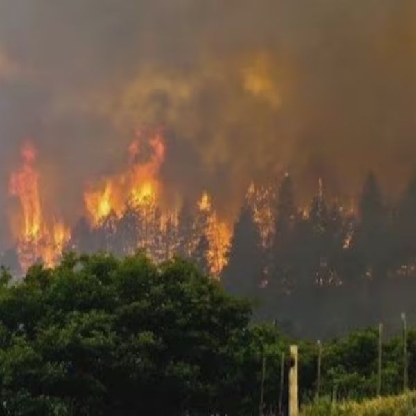
Forecasters warn that gusty winds up to 35 mph, combined with single-digit humidity and dry vegetation, create perfect conditions for wildfires to ignite and spread rapidly.
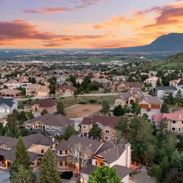
Adding to the concern is a dangerous heat wave gripping the state. Daytime highs are expected to reach the mid to upper 90s, possibly hitting 100 degrees by Thursday or Friday in parts of the Denver metro. Denver’s all-time record high for August 7 is 99 degrees, set in 1980 — a mark that may be tied or broken.
Thursday is likely to be the peak of the heat wave, and forecasters may issue a Heat Advisory if conditions continue to deteriorate. CBS’s First Alert Weather Team has already flagged Thursday as a potential First Alert Weather Day, due to the extreme temperatures expected both during the day and overnight.
Meanwhile, many communities, especially along the Front Range, are also dealing with increased wildfire smoke. The smoke — from fires in Colorado and across the western U.S. — may reduce visibility during the morning and evening hours.
There is some relief in sight. A backdoor cold front is forecast to arrive late Friday or early Saturday, knocking daytime highs down by about 10 degrees and bringing temperatures back closer to August norms. The weekend could also bring isolated storms, offering a small but much-needed break from the dry, volatile weather pattern.

Katie is a senior who has been on staff for three years. Her favorite type of stories to write is reviews and features. Katie’s favorite ice cream flavor is strawberry.


Leave a Reply