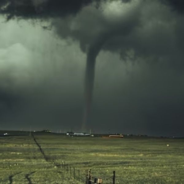
Kit Carson, CO – A Severe Thunderstorm Watch is in effect until 10 p.m. Monday for areas along the Colorado-Kansas border, with Cheyenne, Kit Carson, and surrounding counties facing the threat of strong winds and large hail.
The National Weather Service’s Storm Prediction Center warns that damaging gusts over 60 mph and hail up to golf ball size could impact parts of eastern Colorado—specifically Cheyenne, Kit Carson, Lincoln, Logan, Morgan, Phillips, Sedgwick, Washington, and Yuma counties. In Kansas, Cheyenne and Sherman counties are also under the watch.
Storms are expected to strengthen through the late afternoon and evening, particularly near the I-70 corridor. The weather may lead to power outages, hazardous travel, and localized flooding on rural roads and low-lying areas.
Local officials advise residents to avoid unnecessary travel, secure loose outdoor items, and stay alert to weather updates. Although the current watch ends at 10 p.m., more warnings may follow if storms continue or intensify.
This article has been carefully fact-checked by our editorial team to ensure accuracy and eliminate any misleading information. We are committed to maintaining the highest standards of integrity in our content.

Katie is a senior who has been on staff for three years. Her favorite type of stories to write is reviews and features. Katie’s favorite ice cream flavor is strawberry.


Leave a Reply