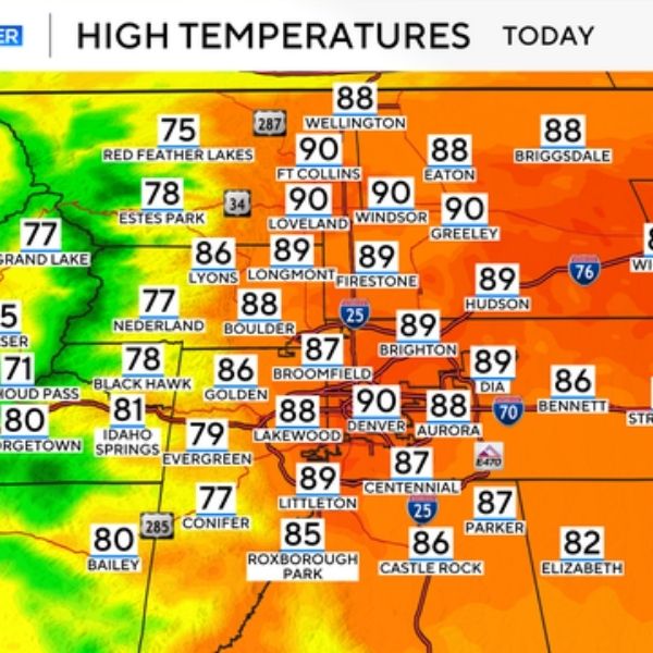
Denver, Colorado — Severe thunderstorms are expected to sweep across northeast Colorado through late Friday, bringing threats of 2-inch hail, 70 mph wind gusts, and isolated tornadoes. Areas from Sterling to Greeley and Limon are in the main impact zone, with the worst conditions likely between 4 p.m. and midnight.
The National Weather Service warns that storms could rapidly intensify during the evening commute, with localized flooding possible. Highways including I-76 and US-34 may be affected by hail, wind, and reduced visibility.
Cities like Fort Morgan, Sterling, and Akron could see some of the strongest storm activity. Residents are urged to avoid non-essential travel, secure loose items outdoors, and stay indoors if warnings are issued. Power outages, fallen trees, and flooded roads are possible, along with lightning and high winds disrupting evening plans.
This system is shaping up to be one of the more intense summer storm events for northeast Colorado, comparable to severe outbreaks seen in recent Junes. Weather alerts may be upgraded or extended as the situation develops.
Stay alert for further updates, as additional advisories could be issued into early Saturday.
This article has been carefully fact-checked by our editorial team to ensure accuracy and eliminate any misleading information. We are committed to maintaining the highest standards of integrity in our content.

Katie is a senior who has been on staff for three years. Her favorite type of stories to write is reviews and features. Katie’s favorite ice cream flavor is strawberry.


Leave a Reply